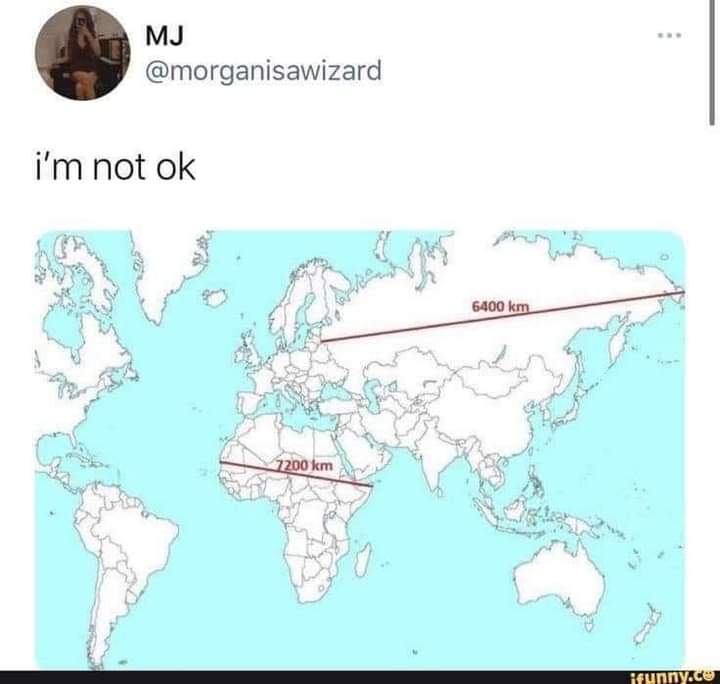
Many map projections do one thing well at the cost of sacrificing others. For example, the popular Mercator projection (which you’ll see in many US schools and textbooks) is well suited for marine navigation but is exceptionally distorted the closer you get to the poles.


This is true. There are some projections that show area more accurately, or shape of landmasses, etc.
For example:
Many map projections do one thing well at the cost of sacrificing others. For example, the popular Mercator projection (which you’ll see in many US schools and textbooks) is well suited for marine navigation but is exceptionally distorted the closer you get to the poles.
I kinda like how the Kavrayskiy VII projection looks. It appears to preserve both the area and the shape fairly well.
this kind of projection is my favourite, it just looks like a map that belongs on a wall
Which makes perfect sense for its use case - navigating from Belgium, Portugal and Spain to Africa, India and Central and South America.